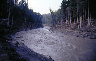
the overlook in 1982
the "high mud" line
Then in the summer of 1983, I went in from the east along logging road 99 to see the devastation area. There were still denuded trees, flattened by the blast, that had not yet been logged. They looked like porcupine quills covering the hillsides.
devastation
the "porcupine quills"


1 comment:
Powerful photos, Roger. It brings back memories. I so remember that day, and the swollen, itchy eyes, the strange gray color of all the leaves. Mostly I remember the wonderful ash that we converted to gorgeous glazes on pottery.
Post a Comment